Gear Review: Getting Ready for Black Fly and Deer Tick Season

Spring is beginning, the snow is melting, and that can only mean one thing; bug season. I’m getting a jump on things by treating my 3 season backpacking gear with a Permethrin based spray.

Permethrin is a synthetic chemical, used by the US military as an insect killer and repellant. It is also effective at killing ticks, including those that carry lyme disease. It is most commonly sold in a liquid, non aresol form. I plan to spray it on my pack, clothing, and shelter to keep the ticks and black flies and mosquitos away. While some may arge DEET is a more effective way to go, I’ve read that the high concentration DEET products can damage the delicate fibers of tents and the like. Most products claim the treatment is good for several weeks, and up to 6 washings. I normally do my best to do a post hike tick check, and to wear long sleeves and pant legs as much as I can stand it. I’m hoping adding this to my defense will make hiking and backpacking even more enjoyable this year! What is your plan to avoid ticks and insects this year?

Obligitory caution (via wikipedia)
Permethrin acts as a neurotoxin, slowing down the nervous system through binding to sodium channels. This action is negatively correlated to temperature, thus, in general, showing more acute effects on cold-blooded animals (insects, fish, frogs…) over warm-blooded animals (mammals and birds):
Permethrin is extremely toxic to fish and aquatic life in general, so extreme care must be taken when using products containing permethrin near water sources.
Permethrin is also highly toxic to cats, and flea and tick-repellent formulas intended and labeled for (the more resistant) dogs may contain permethrin and cause feline permethrin toxicosis in cats.
Very high doses will have tangible neurotoxic effects on mammals and birds, including human beings.
Pesticide grade permethrin is toxic to cats. Many cats die after being given flea treatments intended for dogs, or by contact with dogs having recently been treated with permethrin. Only the less toxic human, pharmaceutical grade Permethrin with well defined impurities and a reduced CIS:TRANS ratio is considered safe for pet use

Permethrin is listed as a “restricted use” substance by the United States Environmental Protection Agency due to its high toxicity to aquatic organisms.
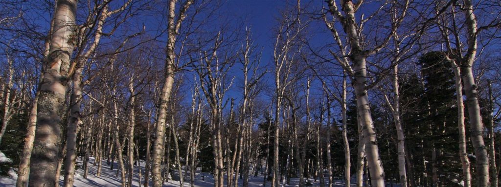

Insect killer and repellent for your clothing is effective against ticks, chiggers, mites and mosquitoes for up to six weeks.


This insect-killing repellent for your clothing is effective against ticks, chiggers, mites and mosquitoes for up to six weeks.

Preparing for a Pemi Loop – 3 Days of Backpacking in the Pemigewasset Wilderness

I’ll be doing a 3 day long, ~33 mile backpacking trip (known as a Pemi Loop) over Memorial Day weekend, and I started planning today. I am pleased to say my pack weight has gone down quite a bit, although I dont always buy gear with weight in mind. Over time I have become more aware on what I need to bring, what I want to bring, and what I bring home that never was used on the trails. I’m sure more items will come along, but I think I am off to a good start.

3daypemi


Under Armour’s performance mesh underwear-the UA Mesh Boxerjock(R) boxer briefs-deliver maximum ventilation and breathability. All the benefits of UA’s original performance underwear, but with an … more info.

Trip Report: Mount Carrigian 3/16/2013

Mount Carrigain is a hike that I would do over and over again. The woods here are very pleasant, the trail is gradual and well designed, and the views from the summit tower are amongst the best in the White Mountain National Forest. The took the normal route, srarting where route 302 meets Sawyer River Road in the town of Livermore, NH. As normal in winter, Sawyer River Rd is gated, adding some miles to our day. There is a trail that exits the winter lot by the trail-head sign, and eventually rejoins the road, which is how we started out, but it was a post hole mess. We cut up to the road and hiked that down to the summer trail-head. We were passed by a few cross-country skiers, and several snowmobiles. We quickly noticed the trail has have several re-routes since the damage from Hurricane Irene. The first few miles are a long approach along the Whiteface Brook. until the junction with the Signal Ridge trail, which has been moved about 1/4 miles from where it once was. After sorting out some route finding, we began the switchback ridden ascent to the ridge. We made great time and the skies were beginning to clear. We finally came out on the exposed bit of Signal Ridge and were awarded some fine views, and layered up for the final push into the trees again and up to the summit tower. Once on the top we took some photos, had a brief lunch, and chatted with some other hikers that got there bit earlier. We made great time on the way out, never once had to change out of our Microspikes all day! The river crossings were not bridged, but were easily manged by hopping on rocks.

GPS/GPX Track

Distance: 14.60 mi
Time: 9:30:16
Avg Pace: 39:04 min/mi
Elevation Gain: 4,341 ft


Whether you’re making an ultra-light alpine Cascade crossing, running on an iced-over trail, or negotiating the glazed sidewalks of winter, the Kahtoola MicroSpikes Traction System will ensure your … more info.

http://www.rei.com/product/768603/snow-peak-litemax-stove

Trip Report: New England Hundred Highest – Mt. Fort, Mt. Coe, North Brother, South Brother

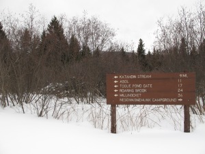
On Wednesday myself and 2 hiking friends made the long drive north to Millionocket, Maine. Our plans were to spend a night at the Appalachian Trail Lodge, then drive to a parking area off Telos Road, and hike/xc ski ~5mi into Baxter State park on Williams Pond Road into a small 10×12 cabin called Camp Cozy located in Nesowadnehunk Campground area the following day. I decided to cross country ski the road, and my 2 friends made the hike in on snowshoes. We got to the cabin in short order, and soon had the stove fired up and made some lunch and gathered water from the nearby stream. The cabin is small, but the stove heated it quickly, and eventually we all went to sleep.

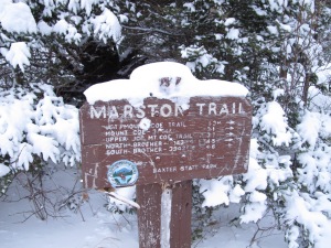
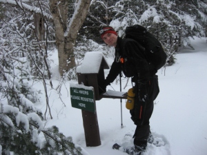
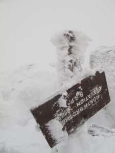
Our original plan was to make 2 hikes over the weekend, day one to North Brother and Fort, and the next day to Coe and South Brother. We awoke to light snowfall on Friday and started off hiking the Tote road down to the Marston Trail head. The ~3 miles went by fast and we signed in on the register, which had just a handful of entries this season. There had been a party of 4 just a few days earlier that had made an attempt but turned back due to very deep snow and we hoped to find some of the trail broken out, but the trail was blown over and covered in new snowfall. We broke trail in 6 or so inches of light snow up to the saddle, and made a left to ascend to North Brother. Winds picked up here and the snow became waist deep, making for very slow progress. At times it took 4 steps to move one, which is very tiring work. Luckily I was with 2 of the strongest hikers I know and eventually we made it to the icy top of North Brother. I was pretty gassed here but decided I would continue on to the trail-less Fort mountain. We picked a good line thanks to Pat’s planning, navigated through a small area of spruce traps, and soon found ourselves at the rocky highpoint.

Turning back the way we came, back up and over North Brother we returned to the saddle to decide our next move. We decided we would try the other 2 peaks on the itinerary, if we ran short of time at least we would get some trail breaking done for the next day. Our thought was we should hike out to Mount Coe first, as it was the longest leg, and we would hit South Brother, a short ~0.3 miles spur off the trail on our way back. Again we ran into some very deep snow, but slowly made it to the destination. The cloud cover afforded us no views. The sun was starting to go down around the time we made the summit of our 4th peak on the day, South Brother. We quickly put on headlamps and began the long hike out. I was running short on water at this point, and my legs were very tired, but there’s nothing one can do but put your head down and push on till you get down. We made good time back to the Marston Trail head, signed out, and began the seemingly endless ~3 mile road walk back to our camp. This bit seemed to take forever and I was running on fumes, thankfully Pat hikes fast and had the stove going when I got back.

None of us had the energy to make a real dinner so we just ate a bunch of snacks, guzzled some water, and got into our sleeping bags. This was the longest hike I’ve ever done, well over 20 miles, but I’m glad we did it all in one day, there’s no way I was going to hike all the way out there a 2nd day in a row. We all slept in Saturday and slowly packed up to hike out a day early. The XC ski in left me with a big blister, so I decided I would snowshoe out back to the cars. My legs still sore, it took 3+ hours to finally make it back to the cars, and we stopped for some food in East Millinocket. I have now hiked to the top of 85 of the New England 100 Highest peaks. What an adventure!

GPS/GPX link

IMG_0278

Pre trip planning

IMG_0279

Ready to pull sleds ~5mi to camp

IMG_6689

I’m not very good on skisIMG_0287

It’s a very nice camp

IMG_0289

There sure is alot of snow!

IMG_0290

Middle of nowhere

IMG_0296

Sunrise at the Marston TH

IMG_6693

Signing us in

IMG_0302

Exhausted on peak 1/4 (North Brother)

IMG_0303

The sign is upside down and covered in rime ice

IMG_6697

Top of Mt Fort

IMG_6700(1)

On Coe

IMG_6705

On South Brother

IMG_0306

Ready to pack out

IMG_0307

Cleaning up the cabin

IMG_0308

Total car-to-car stats:

Avg Moving Pace: 29:06 min/mi

Elevation Gain: 5,935 ft
Elevation Loss: 5,937 ft
Min Elevation: 1,056 ft
Max Elevation: 4,126 ft
Distance: 32.96 mi
Time: 52:59:59
Moving Time: 15:59:12